

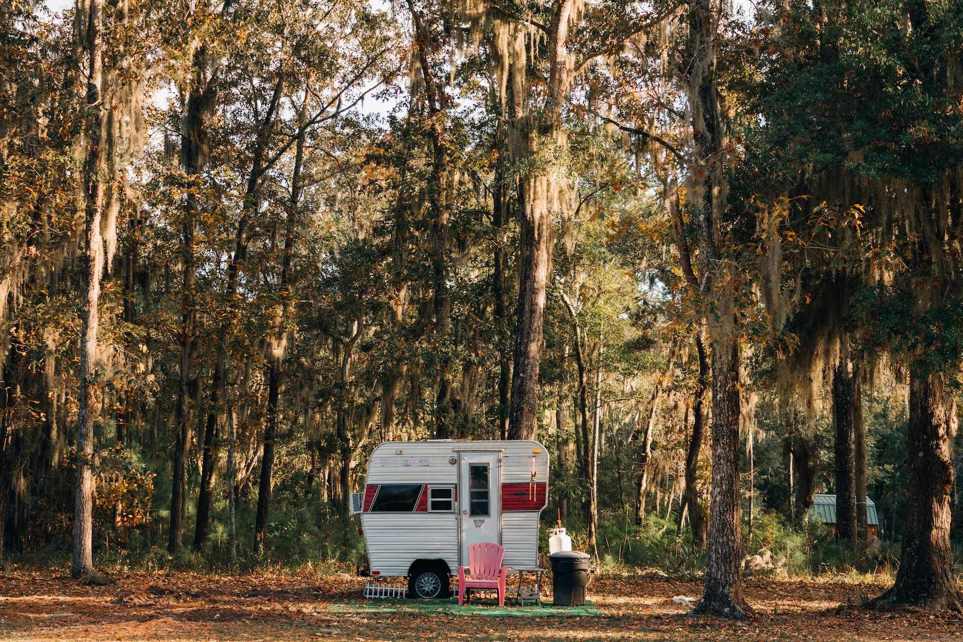
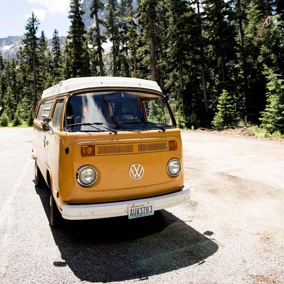
I listen to the consistent hum of Buttercup as she hits 45 mph, the fastest she’ll go for the next 10 miles. Buttercup is a 1976 VW bus and she’s steadily climbing towards Washington Pass on Highway 20. My husband and I have driven this route multiple times, often in a newer, automatic, and air conditioned car. But there is nothing quite like a road trip in Buttercup, where our driving, cooking, and sleeping take place—all under the same hood.
Our final destination is Winthrop and our route to get there crosses the Cascade Mountain Range in Washington state. Commonly referred to as the North Cascades Highway, this is part of the scenic 400-plus mile Cascade Loop. While the full loop requires more than a few days to explore, the 95-mile stretch of Highway 20 from Rockport to Winthrop is our favorite part of the drive.
Late summer or fall is the perfect season for this road trip—which is why I strongly suggest planning a trip soon. The highways close for winter, usually around mid-November or early December to April. The exact dates can vary from year to year depending upon the amount of snowfall. (Visit the Washington State Department of Transportation website for up-to-date information regarding Washington highway closures.)
Here are a few can’t-miss highlights of driving the North Cascades Highway.
Miles 96 to 105: Rockport & Marblemount
Visit Rockport State Park and you’ll instantly be transported into a landscape seldom seen these days. The park’s ancient trees have never been logged, so you’ll be immersed in a canopy of towering evergreens and conifers—some 250-feet tall. This park has a trail for every ability level. Head to the Discovery Center, which is open most weekends throughout the year, and pick the one that’s right for you.
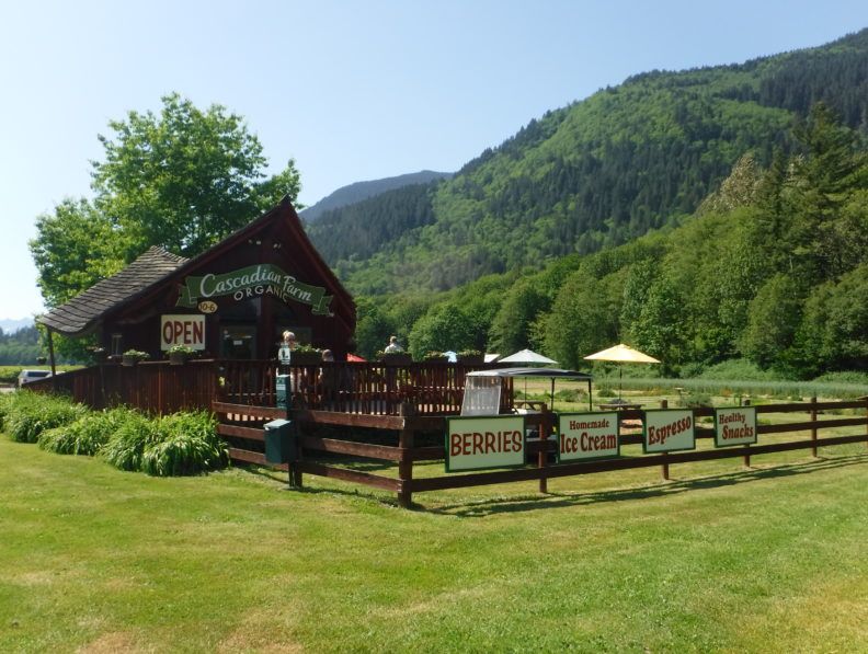
Down the road, stop for a pint of fresh, seasonal berries or homemade organic ice cream at the Cascadian Farm Roadside stand. This is also a great place for a caffeine pick-me-up before getting back on the road. Ten minutes east of Rockport, you’ll enter Marblemount. If you’ve skipped Cascadian Farms, or are still feeling hungry, stop at The Eatery, famous for its sweet cinnamon rolls.
Across the street, you’ll see a tiny church nestled in the trees. Enter Wildwood Chapel and take a seat in one of the six tiny pews. Right behind the church lies the Skagit River. Take a walk along the River Trail before getting back on the road.
Mile 120: Newhalem
Newhalem is the last town along the North Cascades HIghway for the next 60 miles. Here you’ll find easy trails, a waterfall, visitor center and campgrounds galore. Nehalem itself doesn’t encompass much, but the Skagit General Store is worth a stop for road trip snacks and postcards before heading to the North Cascades National Park Visitor Center.
Here, you can learn about the massively beautiful 684,000-acre park that boasts some of the most mountainous and stunningly beautiful wilderness in the U.S. Park rangers are available to provide advice about recreation opportunities and current conditions of the numerous trails in the area.
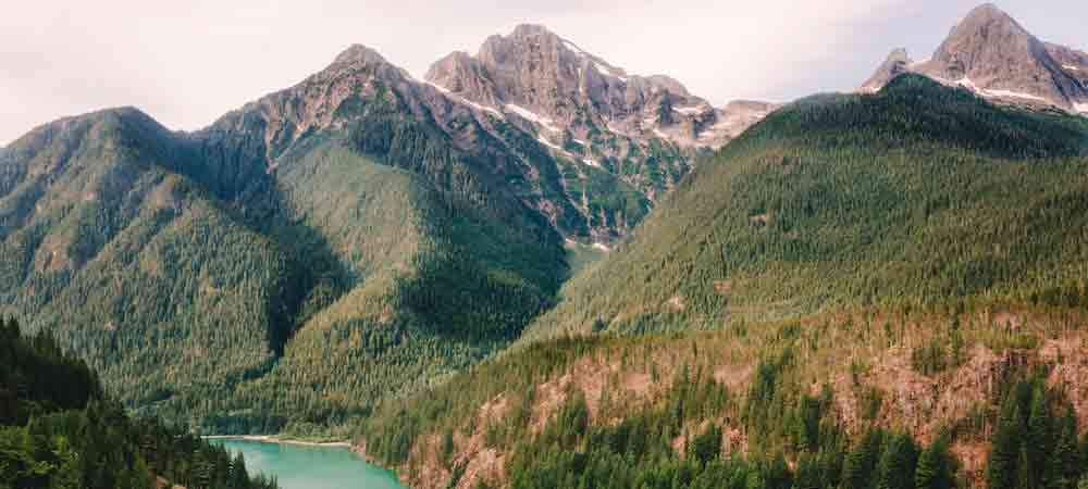
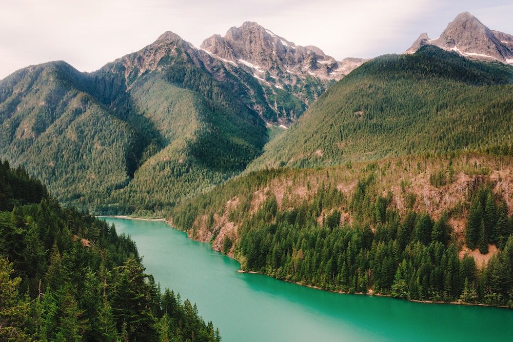 Mile 132: Diablo Lake Overlook
Diablo Lake Overlook is one of the most famous stops along the drive. The beautiful turquoise waters are the product of glacier-ground rock silt, carried down from the surrounding mountains by streams. The silt reacts with light to give the lake it’s greenish-blue hue.
Above the lake, several mountains tower in the sky at 7,000 to 8,000 feet up. The overlook has ample parking, restrooms, and a covered picnic shelter. Interpretive signs are placed throughout the park, displaying geologic and historical facts you can learn as you gaze at the spectacular views.
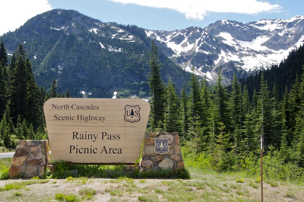 Mile 158: Rainy Pass Picnic
Rainy Pass Picnic Area is a great spot to stop and enjoy a bite. Take the 1 mile, accessible paved trail to Rainy Lake to see local flora and a waterfall. If you want more of challenge, hike the 7.2-mile Maple Loop Trail—one of my favorites—for spectacular views.
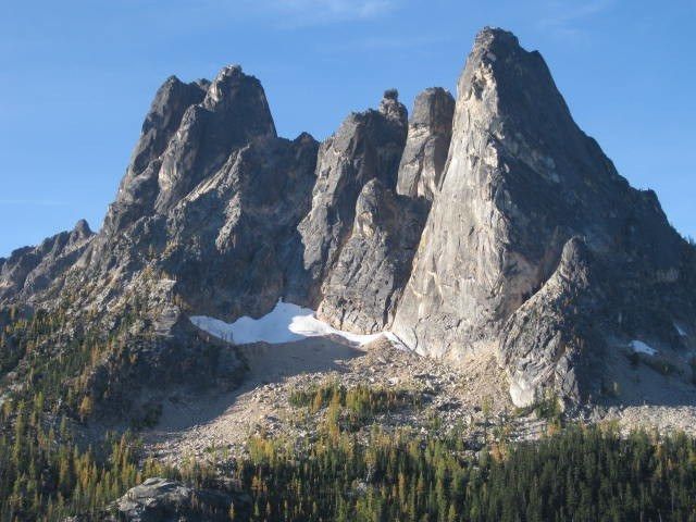 Mile 162: Washington Pass
Washington Pass Overlook is an obligatory stop on the North Cascades Highway. At 5,477 feet, it’s the highest point on the highway. The pass features restrooms, picnic areas, interpretive signage, and an overlook with incredible mountain views. From the parking lot, walk 400 feet along a paved, flat trail to the overlook. Most noticeable from the overlook is the Liberty Bell Group—8,000-feet-high spires that rise dramatically to the south. Don’t forget your camera!
Heading east on the highway, round the wide hairpin turn and begin the long descent.
Miles 179 to 194: The Methow Valley
It’s all downhill from here as the road drops in elevation for about 15 miles before leveling out in the dry Methow Valley. Here, you’ll drive through open fields and ranches, and small towns with lots of character.
The Mazama Store is one of our favorite stops. It’s a family run mercantile, eatery and gas station a short drive off the highway. Inside, you’ll find fresh baked goods, local produce, and local handmade art. Near the store is Goat Peak Lookout, a short but steep trail leading to a historic fire lookout with sweeping views of the valley.
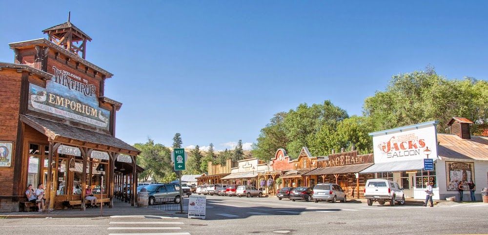
Further down the highway is Winthrop, an old town with wooden boardwalks and a distinct western theme. The Shafer Historical Museum is worth a visit before walking the main street to shop at boutique stores. Winthrop has plenty of options for great food including the Old Schoolhouse Brewery, East 20 Pizza, and the Rocking Horse Bakery.


